
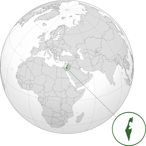
ھۆججەت:ISR orthographic.svg

Size of this PNG preview of this SVG file: 600 × 600 پىكسېل. باشقا چوڭلۇقى: 240 × 240 پىكسېل | 480 × 480 پىكسېل | 768 × 768 پىكسېل | 1,024 × 1,024 پىكسېل | 2,048 × 2,048 پىكسېل.
ئەسلى ھۆججەت (SVG ھۆججىتى، ئاتاقتىكى چوڭلۇقى 600 × 600 نۇقتا، ھۆججەت چوڭلۇقى: 1.39 MB)
ئۈزۈندە
| چۈشەندۈرۈش | |
| چېسلا | |
| مەنبە |
ئۆز ئەسىرىم with Natural Earth Data This W3C-unspecified vector image was created with Inkscape . |
| يازغۇچى | Addicted04 |
ئىجازەت
I, the copyright holder of this work, hereby publish it under the following license:
This file is licensed under the Creative Commons Attribution-Share Alike 3.0 Unported license.
- سىز ئەركىن:
- بەھىرلەش – to copy, distribute and transmit the work
- ئۆزگەرتىش – ئىجادىي ئەسەر
- تۆۋەندىكى شەرتلەرگە چوقۇم ئەمەل قىلىڭ:
- ئىمزا – You must give appropriate credit, provide a link to the license, and indicate if changes were made. You may do so in any reasonable manner, but not in any way that suggests the licensor endorses you or your use.
- ئوخشاش ئۇسۇلدا بەھىرلەش – If you remix, transform, or build upon the material, you must distribute your contributions under the same or compatible license as the original.
ھۆججەت تارىخى
چېسلا/ۋاقىت چېكىلسە ئەينى ۋاقىتتا كۆرۈلگەن ھۆججەتنى كۆرسىتىدۇ.
| چېسلا/ۋاقىت | كىچىك سۈرەت | ئۆلچەم | ئىشلەتكۈچى | ئىزاھات | |
|---|---|---|---|---|---|
| نۆۋەتتىكى | 03:46, 17 مارت 2022 | | 600 × 600 (1.39 MB) | Chaddy | Reverted to version as of 06:27, 24 March 2019 (UTC), there is already another map for the disputed borders: File:Israel (orthographic projection) with disputed territories.svg |
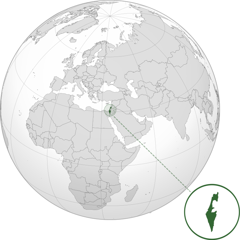
| 09:48, 10 مارت 2022 |  | 600 × 600 (1.4 MB) | Beshogur | Reverted to version as of 06:25, 24 March 2019 (UTC) | |
| 06:27, 24 مارت 2019 |  | 600 × 600 (1.39 MB) | BlueHypercane761 | Reverted to version as of 22:09, 21 September 2016 (UTC) Self-revert. As legitimate as this revision is, I will split it off into a new image file. | |
| 06:25, 24 مارت 2019 |  | 600 × 600 (1.4 MB) | BlueHypercane761 | Restoring previous revision temporarily to retrieve image. | |
| 22:09, 21 سىنتەبىر 2016 |  | 600 × 600 (1.39 MB) | Nableezy | make a new map, this one is fine | |
| 18:50, 16 سىنتەبىر 2016 |  | 600 × 600 (1.4 MB) | Bolter21 | added disputed territories | |
| 03:06, 8 ئىيۇل 2012 |  | 600 × 600 (1.39 MB) | Addicted04 | America land | |
| 02:42, 8 ئىيۇل 2012 |  | 600 × 600 (1.39 MB) | Addicted04 |
_with_disputed_territories.svg)
ھۆججەت ئىشلىتىلىشى
بۇ ھۆججەتنى ئىشلەتكەن بەت يوق.
ئورتاق ھۆججەت ئىشلىتىلىشى
تۆۋەندىكى باشقا ۋىكىلار بۇ ھۆججەتنى ئىشلىتىدۇ:
- af.wikipedia.org دىكى ئىشلىتىشى
- am.wikipedia.org دىكى ئىشلىتىشى
- arc.wikipedia.org دىكى ئىشلىتىشى
- av.wikipedia.org دىكى ئىشلىتىشى
- ay.wikipedia.org دىكى ئىشلىتىشى
- azb.wikipedia.org دىكى ئىشلىتىشى
- az.wiktionary.org دىكى ئىشلىتىشى
- ban.wikipedia.org دىكى ئىشلىتىشى
- bbc.wikipedia.org دىكى ئىشلىتىشى
- bcl.wikipedia.org دىكى ئىشلىتىشى
- bg.wikipedia.org دىكى ئىشلىتىشى
- bh.wikipedia.org دىكى ئىشلىتىشى
- bi.wikipedia.org دىكى ئىشلىتىشى
- bn.wikipedia.org دىكى ئىشلىتىشى
- bs.wikipedia.org دىكى ئىشلىتىشى
- bxr.wikipedia.org دىكى ئىشلىتىشى
- cdo.wikipedia.org دىكى ئىشلىتىشى
- ceb.wikipedia.org دىكى ئىشلىتىشى
- chr.wikipedia.org دىكى ئىشلىتىشى
- ckb.wikipedia.org دىكى ئىشلىتىشى
- cs.wikipedia.org دىكى ئىشلىتىشى
- da.wikipedia.org دىكى ئىشلىتىشى
- dty.wikipedia.org دىكى ئىشلىتىشى
- el.wikipedia.org دىكى ئىشلىتىشى
- en.wikipedia.org دىكى ئىشلىتىشى
- en.wikibooks.org دىكى ئىشلىتىشى
- es.wikipedia.org دىكى ئىشلىتىشى
- eu.wikipedia.org دىكى ئىشلىتىشى
- fi.wikipedia.org دىكى ئىشلىتىشى
- fr.wikipedia.org دىكى ئىشلىتىشى
- gn.wikipedia.org دىكى ئىشلىتىشى
- gu.wikipedia.org دىكى ئىشلىتىشى
- gv.wikipedia.org دىكى ئىشلىتىشى
- hak.wikipedia.org دىكى ئىشلىتىشى
- hr.wikipedia.org دىكى ئىشلىتىشى
- hy.wikipedia.org دىكى ئىشلىتىشى
- id.wikipedia.org دىكى ئىشلىتىشى
- ie.wikipedia.org دىكى ئىشلىتىشى
- incubator.wikimedia.org دىكى ئىشلىتىشى
View more global usage of this file.