
ھۆججەت:Kerala in India.png
Kerala_in_India.png (350 × 426 پىكسېل، ھۆججەت چوڭلۇقى: 76 KB، MIME تىپى: image/png)
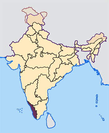
--- Map made by me, Nichalp --- Note: The Indian state of w:Jammu and Kashmir is claimed by w:India, w:Pakistan and the w:People's Republic of China. This map depicts the boundaries of the state as it was in 1947. Areas administered by India is coloured as per the rest of the states, and the area administered by Pakistan and China are coloured in a neutral colour. See the map of Jammu and Kashmir.
The Indian state of w:Arunachal Pradesh is claimed by China as a part of w:South Tibet. The claimed region is depicted in a pale shade of pink. See the map of Arunachal Pradesh.
The Indian territorial waters extend to a distance of twelve nautical miles.

|
Permission is granted to copy, distribute and/or modify this document under the terms of the GNU Free Documentation License, Version 1.2 or any later version published by the Free Software Foundation; with no Invariant Sections, no Front-Cover Texts, and no Back-Cover Texts. A copy of the license is included in the section entitled GNU Free Documentation License. |
| This file is licensed under the Creative Commons Attribution-Share Alike 3.0 Unported license. | ||
| ||
| This licensing tag was added to this file as part of the GFDL licensing update. |
ھۆججەت تارىخى
چېسلا/ۋاقىت چېكىلسە ئەينى ۋاقىتتا كۆرۈلگەن ھۆججەتنى كۆرسىتىدۇ.
| چېسلا/ۋاقىت | كىچىك سۈرەت | ئۆلچەم | ئىشلەتكۈچى | ئىزاھات | |
|---|---|---|---|---|---|
| نۆۋەتتىكى | 07:30, 23 ئاپرېل 2005 | | 350 × 426 (76 KB) | Nichalp | NPOV map |
| 07:21, 23 ئاپرېل 2005 |  | 200 × 231 (22 KB) | Kerpal | Reverted to earlier revision | |
| 06:23, 23 ئاپرېل 2005 |  | 500 × 608 (121 KB) | Nichalp | Reverted to earlier revision | |
| 05:00, 23 ئاپرېل 2005 |  | 200 × 231 (22 KB) | Kerpal | Reverted to earlier revision | |
| 04:54, 23 ئاپرېل 2005 |  | 500 × 608 (121 KB) | Nichalp | Reverted to earlier revision | |
| 21:05, 22 ئاپرېل 2005 |  | 200 × 231 (22 KB) | Kerpal | Reverted to earlier revision | |
| 13:44, 22 ئاپرېل 2005 |  | 500 × 608 (121 KB) | Nichalp | Reverted to earlier revision | |
| 09:48, 22 ئاپرېل 2005 |  | 200 × 231 (22 KB) | Kerpal | originally by en:User:Morwen | |
| 17:59, 21 ئاپرېل 2005 |  | 500 × 608 (121 KB) | Nichalp | --- Map made by me, ~~~ --- Note: The Indian state of w:Jammu and Kashmir is claimed by w:India, w:Pakistan and the w:People's Republic of China. This map depicts the boundaries of the state as it was in 1947. Areas administered by India |
ھۆججەت ئىشلىتىلىشى
تۆۋەندىكى بەت بۇ ھۆججەتنى ئىشلىتىدۇ:
ئورتاق ھۆججەت ئىشلىتىلىشى
تۆۋەندىكى باشقا ۋىكىلار بۇ ھۆججەتنى ئىشلىتىدۇ:
- bxr.wikipedia.org دىكى ئىشلىتىشى
- en.wikipedia.org دىكى ئىشلىتىشى
- incubator.wikimedia.org دىكى ئىشلىتىشى
- it.wikipedia.org دىكى ئىشلىتىشى
- Kerala
- Thiruvananthapuram
- Distretto di Thiruvananthapuram
- Distretto di Alappuzha
- Template:Kerala
- Distretto di Idukki
- Distretto di Kasaragod
- Distretto di Kollam
- Kochi
- Distretto di Pathanamthitta
- Distretto di Ernakulam
- Distretto di Kozhikode
- Distretto di Malappuram
- Distretto di Wayanad
- Kozhikode
- Distretto di Kottayam
- Distretto di Kannur
- Utente:Roberto Mura/SandboxTemplateArchivio
- Distretto di Palakkad
- Distretto di Thrissur
- Alappuzha
- Kollam
- Kannur
- Kasaragod
- Kottayam
- Malappuram
- Palakkad
- Pathanamthitta
- Thrissur
- Kalpetta
- Painavu
- Kakkanad
- Muvattupuzha
- Idukki
- Attingal
- Angamaly
- Azhikode South
- Arookutty
- Adoor
- Avinissery
- Aroor
View more global usage of this file.