
ھۆججەت:XiongnuMap.png
بۇ ئالدىن كۆزىتىشنىڭ چوڭلۇقى: 800 × 467 پىكسېل. باشقا چوڭلۇقى: 320 × 187 پىكسېل | 640 × 373 پىكسېل | 1,024 × 597 پىكسېل | 1,644 × 959 پىكسېل.
ئەسلى ھۆججەت (1,644 × 959 پىكسېل، ھۆججەت چوڭلۇقى: 53 KB، MIME تىپى: image/png)
ئۈزۈندە
| چۈشەندۈرۈش |
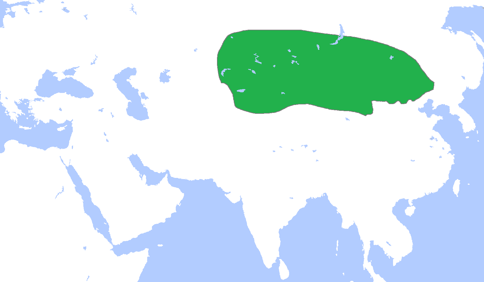
English: Locator map of Xiongnu, c. 250 BC.
(Partially based on Atlas of World History (2007) map.) Deutsch: Hunnenreich ca. 250 v. Chr. |
||
| چېسلا | |||
| مەنبە | ئۆز ئەسىرىم | ||
| يازغۇچى | Gabagool | ||
| Other versions |
|

ئىجازەت
I, the copyright holder of this work, hereby publish it under the following license:
This file is licensed under the Creative Commons Attribution 3.0 Unported license.
- سىز ئەركىن:
- بەھىرلەش – to copy, distribute and transmit the work
- ئۆزگەرتىش – ئىجادىي ئەسەر
- تۆۋەندىكى شەرتلەرگە چوقۇم ئەمەل قىلىڭ:
- ئىمزا – You must give appropriate credit, provide a link to the license, and indicate if changes were made. You may do so in any reasonable manner, but not in any way that suggests the licensor endorses you or your use.
ھۆججەت تارىخى
چېسلا/ۋاقىت چېكىلسە ئەينى ۋاقىتتا كۆرۈلگەن ھۆججەتنى كۆرسىتىدۇ.
| چېسلا/ۋاقىت | كىچىك سۈرەت | ئۆلچەم | ئىشلەتكۈچى | ئىزاھات | |
|---|---|---|---|---|---|
| نۆۋەتتىكى | 01:15, 7 ماي 2009 | | 1,644 × 959 (53 KB) | Gabagool | more reliable |
| 15:57, 24 ئاپرېل 2009 |  | 1,644 × 959 (53 KB) | Gabagool | {{Information |Description={{en|1=Locator map of Xiongnu. (Partially based on Wikimedia Commons maps.)}} |Source=Own work by uploader |Author=Gabagool / Jarle Grøhn |Date=2009-04-24 |Permission= |other_versions= }} <!--{{ImageUpload|f |
ھۆججەت ئىشلىتىلىشى
بۇ ھۆججەتنى ئىشلەتكەن بەت يوق.
ئورتاق ھۆججەت ئىشلىتىلىشى
تۆۋەندىكى باشقا ۋىكىلار بۇ ھۆججەتنى ئىشلىتىدۇ:
- am.wikipedia.org دىكى ئىشلىتىشى
- ar.wikipedia.org دىكى ئىشلىتىشى
- ast.wikipedia.org دىكى ئىشلىتىشى
- azb.wikipedia.org دىكى ئىشلىتىشى
- az.wikipedia.org دىكى ئىشلىتىشى
- ba.wikipedia.org دىكى ئىشلىتىشى
- ca.wikipedia.org دىكى ئىشلىتىشى
- cdo.wikipedia.org دىكى ئىشلىتىشى
- de.wikipedia.org دىكى ئىشلىتىشى
- el.wikipedia.org دىكى ئىشلىتىشى
- en.wikipedia.org دىكى ئىشلىتىشى
- eo.wikipedia.org دىكى ئىشلىتىشى
- es.wikipedia.org دىكى ئىشلىتىشى
- eu.wikipedia.org دىكى ئىشلىتىشى
- fa.wikipedia.org دىكى ئىشلىتىشى
- fi.wikipedia.org دىكى ئىشلىتىشى
- fr.wikipedia.org دىكى ئىشلىتىشى
- gl.wikipedia.org دىكى ئىشلىتىشى
- he.wikipedia.org دىكى ئىشلىتىشى
- hi.wikipedia.org دىكى ئىشلىتىشى
- hr.wikipedia.org دىكى ئىشلىتىشى
- hu.wikipedia.org دىكى ئىشلىتىشى
- id.wikipedia.org دىكى ئىشلىتىشى
- incubator.wikimedia.org دىكى ئىشلىتىشى
- ja.wikipedia.org دىكى ئىشلىتىشى
- ko.wikipedia.org دىكى ئىشلىتىشى
View more global usage of this file.