
ھۆججەت:Waterfalls of coo belgium.jpg

بۇ ئالدىن كۆزىتىشنىڭ چوڭلۇقى: 800 × 600 پىكسېل. باشقا چوڭلۇقى: 320 × 240 پىكسېل | 640 × 480 پىكسېل | 1,024 × 768 پىكسېل.
ئەسلى ھۆججەت (1,024 × 768 پىكسېل، ھۆججەت چوڭلۇقى: 176 KB، MIME تىپى: image/jpeg)
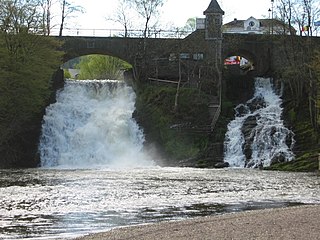
| چۈشەندۈرۈش | The waterfalls of coo |
| چېسلا | |
| مەنبە | ئۆز ئەسىرىم |
| يازغۇچى | User:Boris23 |
| Camera location | | View this and other nearby images on: OpenStreetMap |
|---|
| I, the copyright holder of this work, release this work into the public domain. This applies worldwide. In some countries this may not be legally possible; if so: I grant anyone the right to use this work for any purpose, without any conditions, unless such conditions are required by law. |
ھۆججەت تارىخى
چېسلا/ۋاقىت چېكىلسە ئەينى ۋاقىتتا كۆرۈلگەن ھۆججەتنى كۆرسىتىدۇ.
| چېسلا/ۋاقىت | كىچىك سۈرەت | ئۆلچەم | ئىشلەتكۈچى | ئىزاھات | |
|---|---|---|---|---|---|
| نۆۋەتتىكى | 23:11, 30 دېكابىر 2004 | | 1,024 × 768 (176 KB) | Boris~commonswiki | {{GFDL}} |
ھۆججەت ئىشلىتىلىشى
تۆۋەندىكى بەت بۇ ھۆججەتنى ئىشلىتىدۇ:
ئورتاق ھۆججەت ئىشلىتىلىشى
تۆۋەندىكى باشقا ۋىكىلار بۇ ھۆججەتنى ئىشلىتىدۇ:
- br.wikipedia.org دىكى ئىشلىتىشى
- ca.wikipedia.org دىكى ئىشلىتىشى
- ceb.wikipedia.org دىكى ئىشلىتىشى
- cs.wikipedia.org دىكى ئىشلىتىشى
- de.wikipedia.org دىكى ئىشلىتىشى
- de.wikivoyage.org دىكى ئىشلىتىشى
- en.wikipedia.org دىكى ئىشلىتىشى
- es.wikipedia.org دىكى ئىشلىتىشى
- fr.wikipedia.org دىكى ئىشلىتىشى
- fr.wikivoyage.org دىكى ئىشلىتىشى
- ha.wikipedia.org دىكى ئىشلىتىشى
- hr.wikipedia.org دىكى ئىشلىتىشى
- hu.wikipedia.org دىكى ئىشلىتىشى
- incubator.wikimedia.org دىكى ئىشلىتىشى
- it.wikipedia.org دىكى ئىشلىتىشى
- ksh.wikipedia.org دىكى ئىشلىتىشى
- lb.wikipedia.org دىكى ئىشلىتىشى
- nl.wikipedia.org دىكى ئىشلىتىشى
- pl.wikipedia.org دىكى ئىشلىتىشى
- sk.wikipedia.org دىكى ئىشلىتىشى
- www.wikidata.org دىكى ئىشلىتىشى